
The Global Climate Prospectus will describe impacts across the globe, at high resolution. That means choosing administrative regions that people care about, and representing impacts within countries. However, choosing relevant regions is tough work. We want to represent more regions where there are more people, but we also want to have more regions where spatial climate variability will produce different impacts.
We now have an intelligent way to do just that, presented this week at the meeting of the American Geophysical Union. It is generalizable, allowing the relative role of population, area, climate, and other factors to be adjusted while making hard decisions about what administrative units to combine. Â See the poster here.
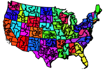
Below is the successive agglomeration of regions in the United States, balancing the effects of population, area, temperature and precipitation ranges, and compactness. The map progresses from 200 regions to ten.
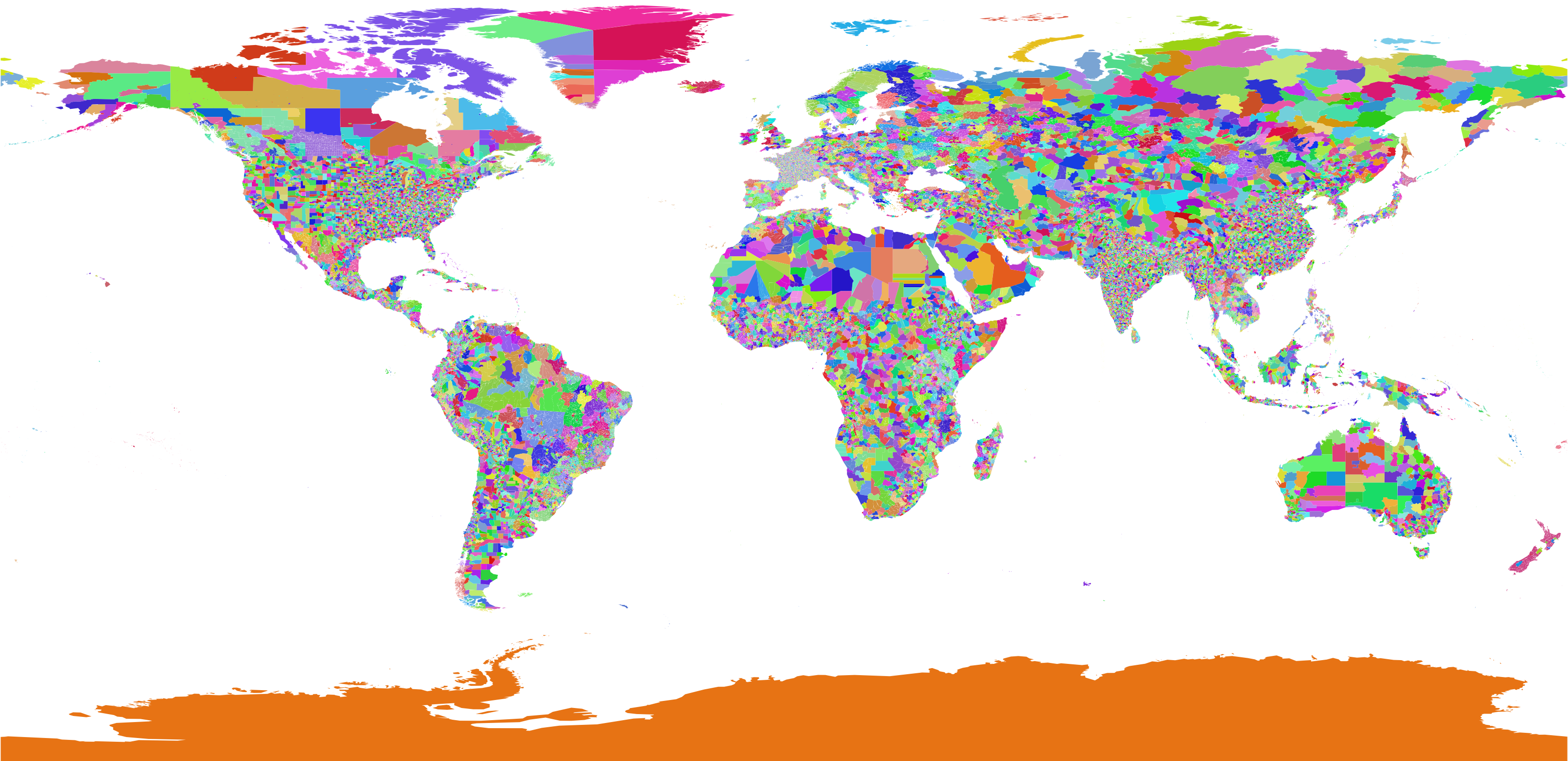
Across the globe, some countries are maintained at the resolution of their highest available administrative unit, while others are subjected to high levels of agglomeration.
The tool is generalizable, and able to take any mechanism for proposing regions and scoring them. That means that it can also be used outside of the GCP, and we welcome anyone who wants to construct regions appropriate for their analysis to contact us.

0 responses so far ↓
There are no comments yet...Kick things off by filling out the form below.