
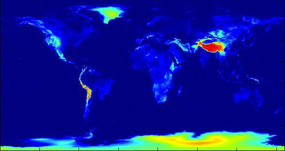
Elevation can be an important variable to consider, but the elevations represented in a digital elevation model (DEM) might not correspond very well to those that impact people. Agriculture can be a good proxy for where people are.
First, I generated a .5x.5 degree map of where grains are grown (barley, maize, millet, rice, sorghum, soybeans, and wheat). Then I used it to generate a .5x.5 degree DEM, based on GLOBE, where the elevation of each grid cell is a average of the elevations available in the finer resolution of GLOBE, weighted by the area of grains grown in the coarse pixel.
Here’s an image of the DEM. Download the 360×720 CSV.
0 responses so far ↓
There are no comments yet...Kick things off by filling out the form below.